(BIVN) – Major Hurricane Dora is on a track to pass far south of Hawaiʻi island, however there are still various wind and surf warnings in effect for the Big Island.
As of 5 a.m. on Monday morning, Dora was a category 4 hurricane on the Saffir-Simpson Hurricane Wind Scale, with maximum sustained winds near 130 mph. Dora was 675 miles southeast of Hilo, and moving west near 23 mph. This motion is expected to continue for the next several days.
“Breezy easterly trade winds are forecast to become strong and gusty later today through midweek as Hurricane Dora passes far to the south,” wrote the National Weather Service on Monday morning. “Outside of a few windward showers this morning, very dry air arriving from the east will limit rainfall chances through Wednesday.”
A High Wind Warning is in effect for the entire island of Hawaiʻi through 6 a.m. on Wednesday. East winds 30 to 45 mph with gusts over 65 mph expected.
“Satellite imagery showed the leading edge of a very suppressed and dry air mass approaching from the east, which also marks the leading edge of the easterly wind surge,” the National Weather Service in Honolulu stated. “This drier air (PWs dipping well below normal) combined with a strong pressure gradient between Dora passing to the south and high pressure to the north will support strong and gusty winds later today through midweek. The subsidence inversion is forecast to dip to around 3000 ft, which is well below normal. This stable/dry air and low inversion combined with the strong pressure gradient (50 kt winds shown around the inversion to 850 mb) will generate advisory to warning-level wind speeds this afternoon through Wednesday.”
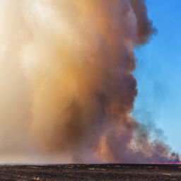
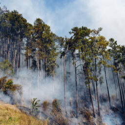
A Red Flag Warning has also been issued for leeward portions of the Big Island. “Very dry fuels combined with strong and gusty easterly winds and low humidities below 45 percent will produce critical fire weather conditions through Tuesday night,” forecasters said. The warning area includes Kona, Kohala, and the Big Island interior.
In addition, there is a High Surf Warning for east facing shores of Hawaiʻi island from 6 p.m. Monday evening to 6 p.m. Tuesday. “Dangerously large breaking waves of 10 to 15 feet” will be possible due to the “combination of very strong trades, large seas and a moderately sized, moderate period easterly swell generated from Dora.”
From the Central Pacific Hurricane Center in Honolulu at 5 a.m. HST:
The satellite presentation of Dora has degraded some overnight with the convective ring of cold dense overcast warming slightly. This is likely due to the ingestion of some drier mid-level air and possibly going through an eyewall replacement cycle. The latest subjective Dvorak current intensity estimates from PHFO, SAB, and JTWC came in at 6.0 (115 kt), 6.5 (127 kt), 6.0 (115 kt) respectively, while the objective Dvorak ADT and AiDT estimates from UW-CIMSS were 105 kt and 109 kt. Using a blend of these data, the initial intensity is lowered to 115 kt with this advisory.
Dora is moving slightly south of due west at 20 kt. This general motion is expected to continue during the next several days as a deep layer ridge builds to the north of the Hawaiian Islands. A turn to the northwest is forecast beyond day 3 as the tropical cyclone rounds the southwestern periphery of the deep layer subtropical ridge to the north of Hawaii. On this forecast track, Dora is expected to move into the western Pacific basin late this week. The forecast track is virtually a carbon copy of the previous advisory and is roughly a blend of the HCCA and TVCN consensus guidance and deterministic GFS and ECMWF guidance.
The environmental conditions along the forecast track of Dora are generally conducive for maintenance of a very intense tropical cyclone during the next several days, with the exception of the mid-level dry air surrounding the system. Vertical wind shear will remain low during the next 4 days, while sea surface temperatures remain around 27C through around day 3. From day 3 onward, the SSTs increase into the 28/29C range, with vertical wind shear rising substantially by day 5. Although the satellite presentation of Dora has degraded slightly overnight, the continued annular appearance should prevent a rapid weakening of the system, and the official intensity forecast calls for a very slow and steady weakening trend during the next couple days. Beyond 48 hours, a slight increase in sea surface temperatures and ocean heat content may allow for some intensification of the tropical cyclone. As a result, the official intensity forecast has been increased slightly for days 3 and 4, with a rather sharp decrease in intensity shown by day 5 as increasing vertical wind shear should begin overwhelming Dora. This forecast is essentially a blend of the statistical and dynamical intensity guidance.
Big Island News, August 7, 2023


